

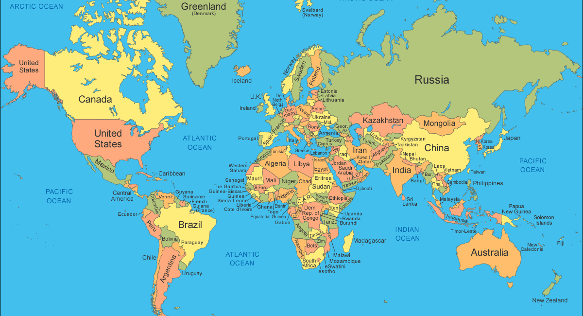

The United Nations General Assembly (UNGA) has adopted an African proposal for a new world map which shows countries’ true sizes relative to one another.
The resolution, passed on Friday, seeks to give an “equitable” representation of the world’s regions, particularly Africa.
According to the resolution, the distortions in the current world map have resulted in the continent’s “symbolic minimization” in people’s collective imagination.
The resolution was adopted with 164 countries voting in favour, six abstaining, and only the United States voting against it. The countries that abstained were Ukraine, Estonia, Lithuania, Georgia, Moldova, and Serbia.
At present, many of the world’s maps are based on the Mercator projection, created by European cartographer Gerardus Mercator in 1569 to aid navigation at sea.
Mercator initially made globes before transferring his map from a three-dimensional curved surface to a flat sheet of paper.
However, the projection distorts the true size of countries, as the northern side of the globe was stretched to produce a usable map. That map is still widely used in classrooms and GPS systems around the world.
The African Union (AU), alongside other African advocacy groups, has long backed a “Correct the Map” campaign to replace the 16th-century world projection.
Last year, the campaign said it had submitted a request to the UN’s geospatial body for consideration.
The adopted UN resolution noted “with concern that this distortion contributes to minimizing the perceived sizes of Africa, Latin America and South Asia, and perpetuating an unbalanced view of the world”.
It added that the projection also “contribute to minimizing the extent of socioeconomic realities, infrastructure needs, development potential and prosperity in the Southern regions, and that they can fuel prejudices in the environmental, geopolitical and security fields.”
The UN vote is non-binding but will see changes to the maps used by institutions around the world.